Physical Maps of South Carolina
Colonial Map of South Carolina
|
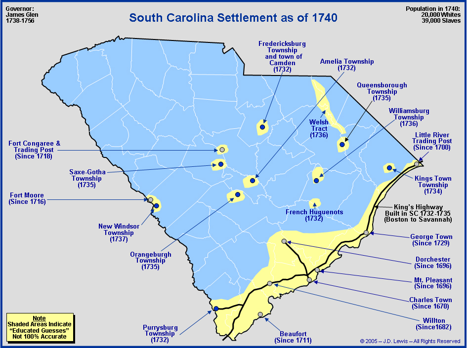
A colonial map as of 1740 of South Carolina is showed on the left. As you can see, most of the town are on the cost, as South Carolina did a lot of maritime trading. Some of the significant towns are Charles Town and George Town, along with Beaufort, the second oldest city in the colony following Charles Town.
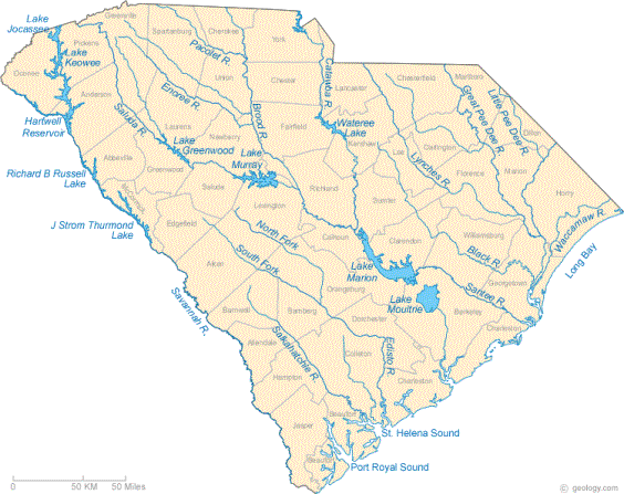
On the left here is a geographical map of the South Carolina region. one can see that there are many lakes spread throughout the colony, so there will be sufficient water supply. Also, rivers are spread throughout the whole state, promoting mainland shipping. Also, since this the state is located in the coastal area, the weather will be more comfortable, with warm summers and mild winters, and not cold like the colonies up North, so you will always work in comfort. The colony is hilly and swampy in some places. This variety in landforms makes for a great place to live, with all the variety. The colony is here seen in a full colonial perspective. Again, you can see that it is down south, next to the Atlantic. A map of the original thirteen colonies are displayed on the left, with South Carolina highlighted in red. As you can see, it is conveniently located on the southeast corner of the New World.
|
